Ajijic is situated on a narrow strip of land between the mountains to the north and the lake to the south, nestled between San Antonio Tlayacapan to the east and San Juan Cosala to the west. It lies seven kilometers west of Chapala. Its average annual temperature is 22 degrees Celsius (72°F), considered one of the best climates in the world.
Founded in 1531, its name comes from the Nahuatl word Axixic, meaning “where the water spills” or “where the water springs forth.” It is one of the oldest towns in Mexico. In the 1950s, Ajijic had a population of 6,000. Today, that figure has grown to 11,000. It is still considered a hospitable and peaceful town, attracting adventurers from all corners of the globe. It has the largest concentration of expatriates in the Lake Chapala area.

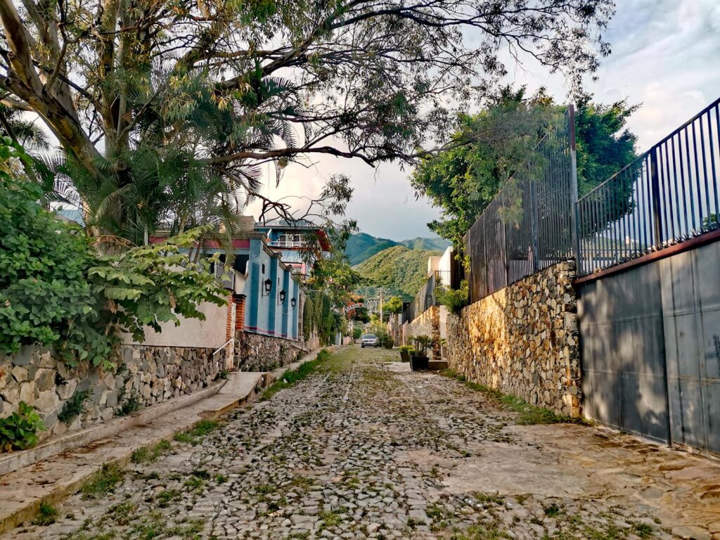
Its streets are narrow, cobbled, and colorful, with a wide variety of beautiful murals adorning some of them. The sounds and magic of the town are everywhere: church bells, horses’ hooves, roosters crowing at dawn, the band playing “Las Mañanitas,” the ice cream vendor’s song, and the characteristic sounds of a Mexican town.
Ajijic maintains its Mexican identity while also offering tourists a variety of services, with an abundance of hotels, inns, and restaurants—probably more than any other Mexican town of its size. It is located 40 minutes from Guadalajara (the second largest city in Mexico), surrounded by mountains and the beauty of Lake Chapala, with its colorful streets, beautiful murals, cobblestone roads, restaurants, galleries, clothing stores, inns, cafes, and more.

The community of Americans and Canadians who reside here make it a cosmopolitan place, full of culture and art, and a relaxing destination for retirees.
Some things you can’t miss when visiting Ajijic are:
- Strolling along the beach and boardwalk and taking a dreamlike photo.
- Trying the food at some of the restaurants, which offer a wide variety of menus and international cuisine.
- Horseback riding.
- Relaxing on one of the benches in the beautiful art-filled plaza.
- Walking the streets and enjoying the murals and art galleries.
- If you come on a Wednesday morning, stroll through the Ajijic Tianguis (market).
Ajijic, a Town with Magic!
Brief Description of Ajijic
Axixic: Nahuatl etymology Atl- water, xictli- navel, axixime- spills or scatters, c- apocope of CO- location.
“The eye of water that spills” pronunciation: ah-shee-sheek.

Pre-Hispanic foundation of Axixic in 1472 by Hueytlatoani Cacalotzin (venerable raven) chief of the ceremonial center… Teopantitlan founded the town of Ajijic in honor of his daughter Xochippilli. In 1523, Captain Alonso Avalos conquered the Axixic lagoon and part of Colima. In 1527, Captain Francisco Cortez and a group of friars arrived in Axixic and Cuetzalan, building the first churches. In 1531, Nuño de Guzmán and Fray Martin de Jesús or de Coruña arrived and were received by Xitomatl. They moved to Tomatlan, where they built a church in honor of the Virgin of the Assumption. A storm hit, and they moved to Tecolotlan (between Puerta Nueva and Azezenca). Another storm hit, and they moved to Axixic.
Here, the indigenous people were baptized, with Xitomatl taking the name Andres Carlos (in honor of Saint Andrew the Apostle and Carlos, Emperor of Spain). The town was baptized with the name “San Andrés de Axixic.” The first chapel was built in honor of the Virgin of the Rosary, along with a small hospital and convent (House of Dreams Juarez and Hidalgo).
In 1512, it became part of the great audience of Guadalajara.
Present Day
Territory: It has 5,657 hectares, including ejidos, indigenous communities, private property, former haciendas, pastures, cedars, and canyons.
Borders: North with the Sierra del Tecuan, Vigas, Travesaño. West: San Juan Cosala, East: San Antonio, South: Lake Axixic.
Neighborhoods: Sagrado Corazón de Jesús (Canacinta), San Sebastián (Ojo de Agua), Guadalupe (Tecoluta), San José (Nicolás de Chapala), San Miguel (Santo Santiago).
Temperature: 19.9°C, dry to semi-warm.
Location: 42 km from Guadalajara, 7 km from Chapala.
Altitude: 540 meters above sea level.
Economy: Tourism, construction, floriculture, artisans, professionals, domestic workers, artists.
Recreational areas: Cultural center, auditorium, galleries, restaurants, cinema, bullring, Friendship Park, pier, beach, main square, Tepalo stream, Seis Esquinas.
Hills: 15 Chilar, Ancha, del Tepalo, Tempisque.
Mines: 18 most important, “del Oro” ceased to function in the 45s.
Archeology: (monoliths) Piedra Rayada, Bailadora, del Campanario, Palo Grande, Nahualla, La Zapota, La Tortuga (outside the cultural center).
Main festivals: San Sebastián (papaqui), Carnival (zayacas), Holy Week living Stations of the Cross, August anniversary of the parish and cultural center, Danza del Sol (Mesa de los Encinos), September 15th patriotic celebrations, October 31st Virgin of the Rosary, November 2nd Day of the Dead (cemetery, cultural center esplanade), November 20th-30th San Andrés festival (pilgrimage with guilds), December 12th Virgin of Guadalupe (neighborhood), Christmas posadas in the town’s neighborhoods, New Year’s celebration, New Year’s parade.


